Wetlands
Wetland ecosystems play a significant role in land-atmosphere carbon exchange and are vital components of the global climate system. Accurate assessment of wetland inundation dynamics is essential for comprehending their function as carbon sinks and for devising effective mitigation strategies to address climate change.
I have collaborated with NASA to map and model wetland systems across the Western Hemisphere, including:
• Pacaya Samiria Reserve, Peruvian Amazon
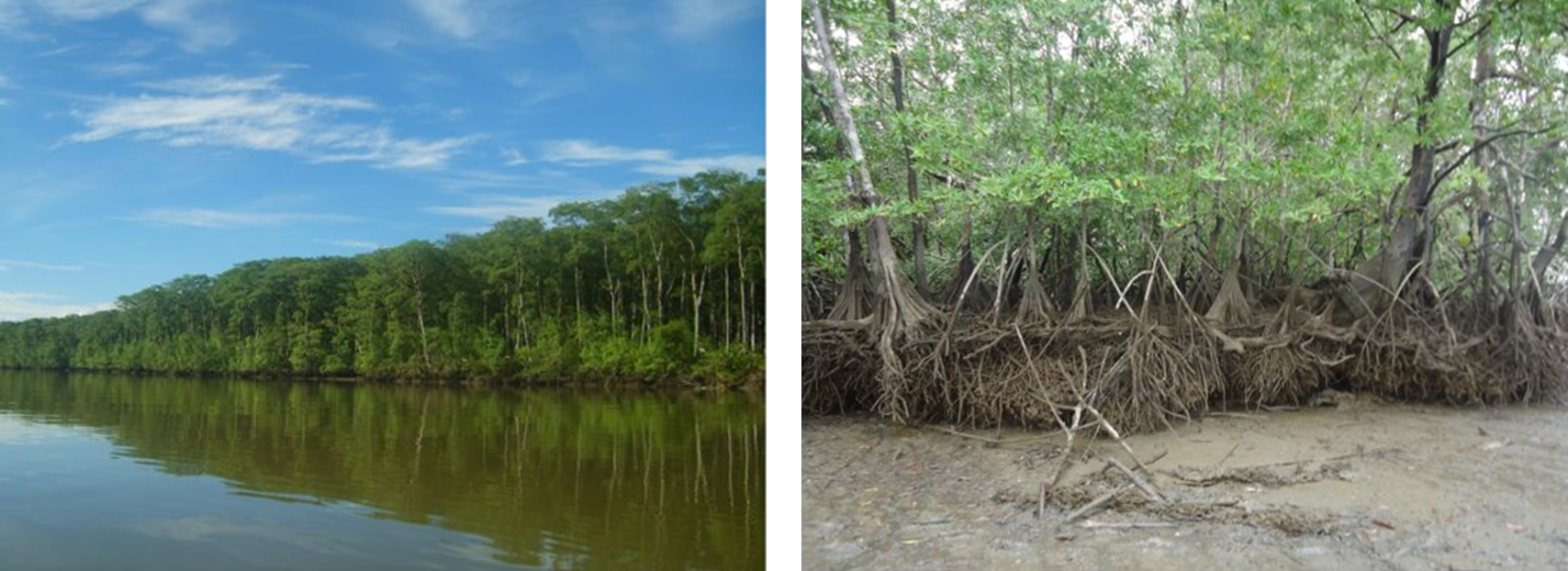
• Timbiqui, Pacific Coast of Colombia
• Wheeler Marsh, Long Island Sound
NASA-ISRO SAR Mission
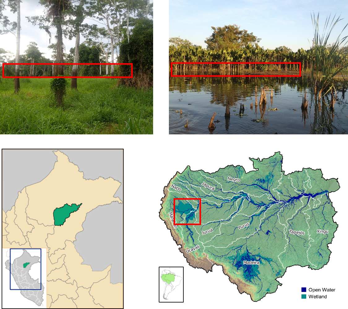
NISAR is a joint Earth-observing mission between NASA and the Indian Space Research Organization (ISRO). A primary objective of the NISAR mission is the accurate and consistent monitoring of wetlands inundation to support a variety of science needs. Our collaboration team has established a monitoring framework in the Pacaya Samiria National Reserve, Peru, to support NASA mission objectives in tropical wetlands.
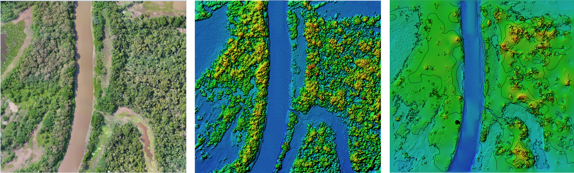
Peru’s Ucayali-Marañon is home to the Pacaya Samiria National Reserve. This reserve encompasses the largest tropical flooded forest in the Peruvian Amazon and is the most expansive protected wetlands area in the Amazon basin.
There is a pronounced seasonal flood pulse raising river water levels greater than 10 m (flood marks indicated in the photos on the right). As a result, a vast amount of the region experiences enhanced inundation for months every year.
Topographic and climatic conditions, along with water availability, support the Pacaya Samiria’s high ecological richness, biodiversity, and prevalent wetlands ecosystems. The goal of this project is to assess inundation extent and dynamics in a tropical wetlands complex.